Houston, my beloved swamp of a hometown, has apparently become the Atlantic's favorite punching bag in 2026. We've had two named storms, Arthur and Bertha, and both decided to swing by for a visit, their centers passing near or directly overhead. You'd think that'd be notable, but in the grand scheme of hurricane seasons, these two were about as menacing as a gentle breeze on a humid day.
Now, before you start stocking up on canned goods, let's look at the numbers. According to the Accumulated Cyclone Energy (ACE) index - the hurricane nerd's favorite measuring stick - we're sitting at less than 30% of the usual activity for this time of year. Normally, we'd have seen three or four named storms by now, with at least one graduating to hurricane status. Instead, we're looking at a season that's about as exciting as a C-SPAN marathon.
Even the big brain of hurricane forecasting, Phil Klotzbach from Colorado State University, has been dialing back his predictions faster than a meteorologist on a hot mic. In April, he thought we'd get 13 named storms and six hurricanes. By Wednesday's final outlook, he's down to nine named storms and four hurricanes, with ACE at only 40% of normal. That's music to the ears of coastal residents from South Texas to Maine, who can finally put away their storm shutters for a bit.
Why the sudden cold feet from the weather gods? It's all thanks to a strengthening El Niño in the Pacific, which is throwing wind shear across the Atlantic like a cosmic hairdryer. Klotzbach is 'extremely confident' we'll have a strong El Niño for the peak of hurricane season, and he's predicting a 'well below-average probability for major hurricane landfalls' in the US and Caribbean. Sounds great, right?
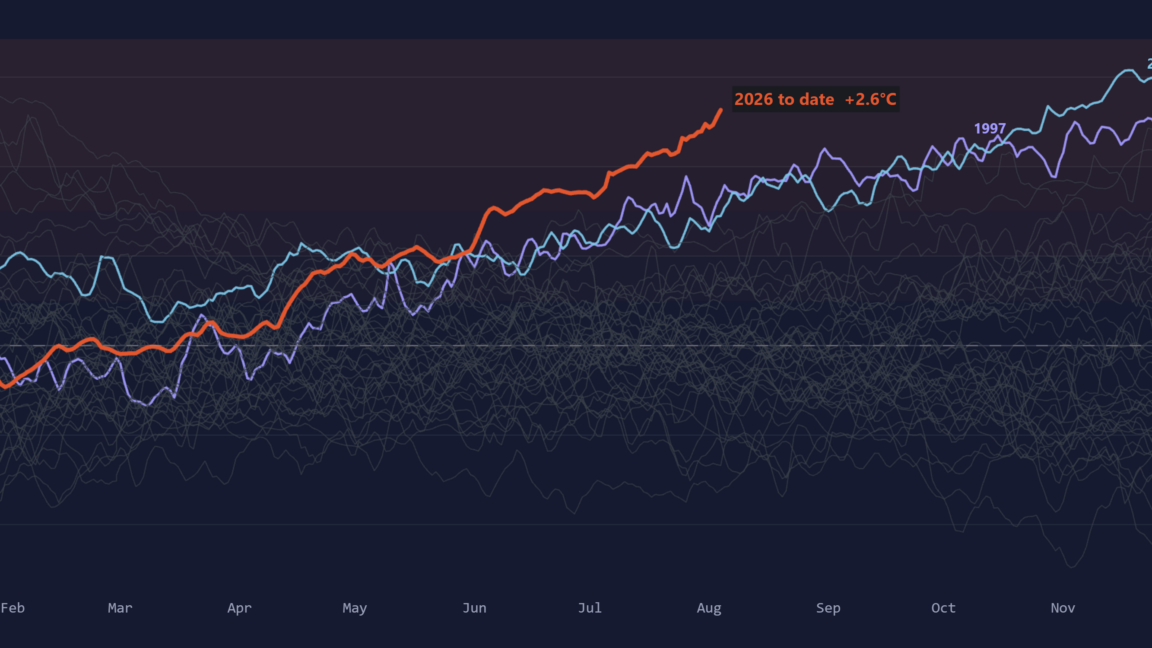
But hold on to your beach hats, because there's a catch. This El Niño isn't just strong; it's potentially record-breaking. Zeke Hausfather, a climate scientist, notes that the multi-model median for the event's peak is 3.6°C - a full 0.8°C hotter than the previous record of 2.75°C set in 2015-16. To put that in perspective, the gap between the strongest and fifth strongest El Niños of the past 150 years is only 0.5°C. We're talking about something 'outside the envelope of anything we have ever observed.'
And what does a mega-El Niño mean? More fuel for global warming. The warming effect lags the peak by a few months, so 2027 is shaping up to be the hottest year on record, further messing with our planet's already fragile state. So while we might dodge a few hurricanes, we're essentially trading them for a global heatwave that'll make summer 2026 look like a Polar Bear plunge.
The Good Times
News in your inbox.
One sardonic roundup, delivered on your schedule. Free. Unsubscribe whenever your tolerance for wit runs out.
Already subscribed but we never reach your inbox? Check your spam folder and hit 'Not spam' (or 'Remove from spam') to bust us out of junk-mail purgatory. You'll be helping everyone else too.
Don't open any of our emails for a month and you'll be automatically removed from the mailing list.
Rewrite Article
Select parts to regenerate with a fresh AI pass. Translations will be updated automatically.
Generate AI Image
Creates a sardonic version of the article image using OpenAI.