
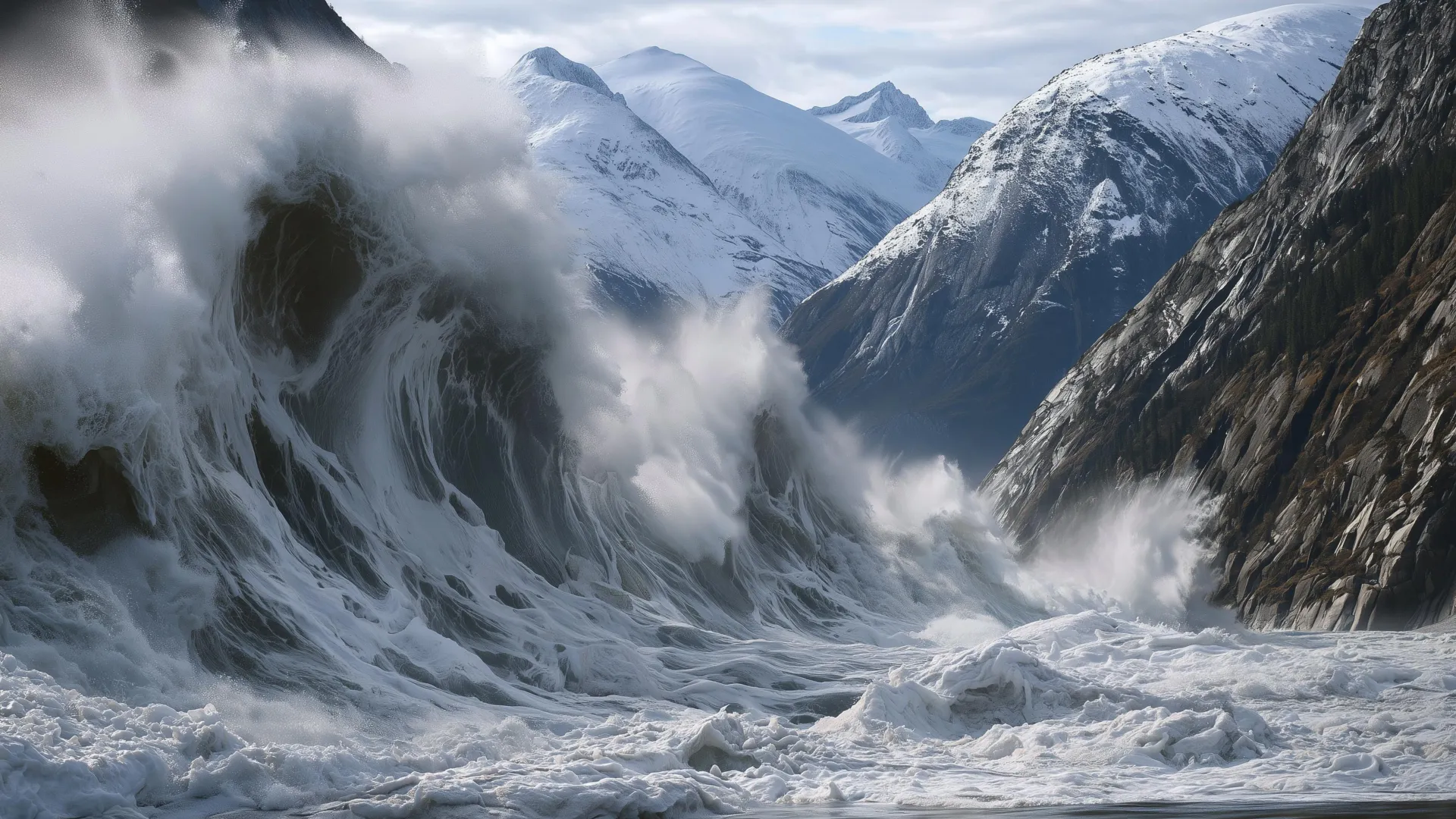
On the evening of Aug. 9, 2025, passengers aboard the Hanse Explorer wrapped up their selfie-and-video session at the South Sawyer Glacier and the ship headed back down the fjord. Twelve hours later, a mountain next door decided to collapse into the fjord, generating the second-highest tsunami in recorded history. The tourists, blissfully unaware, had sailed through a landscape on the verge of failure - and were lucky enough to leave before it failed.
Researchers at the Alaska Earthquake Center - one of whom serves as Alaska's state seismologist - detail in a new study how the landslide sent water and debris 1,580 feet (481 meters) up the opposite side of the fjord. That's higher than the top floor of Taipei 101. The water then continued down Tracy Arm, stripping the fjord's walls down to bare rock. It was just after 5 a.m. on a dreary day, and fortunately, no ships were nearby. In the months since, some cruise lines have started avoiding Tracy Arm. The conditions that caused all this, however, are not remotely unique to that one fjord.
Landslides are common in Alaska's coastal mountains, where rapid tectonic uplift and long-term ice loss meet the erosive forces of precipitation and moving glaciers. But a curious pattern has emerged: multiple major landslides have occurred precisely at the terminus of a retreating glacier. The mechanics are still poorly understood, but these mountains appear to become unstable when the ice disappears. When millions of tons of rock hit the water, the momentum becomes tsunami waves.
The same phenomenon is unfolding from Alaska to Greenland and Norway, sometimes with deadly consequences. Arctic countries are now grappling with the hazard, and the options are not attractive: avoid vast swaths of coastline, or live with a poorly understood risk. The authors argue there is an obvious role for alert systems - but only if scientists get better at predicting where and when landslides are likely to strike.
The Tracy Arm event is a powerful case study. The landslide occurred in August, when warm ocean waters and heavier precipitation favor both glacier retreat and slope failure. The glacier below the slide area had experienced rapid calving and had retreated more than a third of a mile in the two months prior. Heavy rain had been falling, entering fractures in the mountain and pushing them closer to failure by increasing water pressure in the cracks. Most provocative: thousands of small seismic tremors emanated from the slide area in the days before the collapse.
According to the researchers, that combination of signs would have justified progressive alerts to any ships in the vicinity and to homes and businesses that could have been harmed by a tsunami - at least a day before the failure - had a monitoring program existed. Escalating alerts are already used for everything from terrorism and nuclear plant safety to avalanches and volcanic unrest. They don't remove risk, but they make it easier to coexist with hazards. Avalanches still kill people, yet alert systems have made winter backcountry travel safer for many.
The authors believe the weather and rapid glacier retreat in early August 2025 were likely sufficient to issue a "yellow" alert on a yellow-orange-red scale, notifying people that hazard may be temporarily elevated in a general area. In the hours before the landslide, an exponential increase in seismic events and the telltale transition to seismic tremor - a continuous "hum" of seismic energy - warranted an "orange" alert noting immediate concern. Arguably, the signs justified recommending that boats and ships stay out of the fjord.
The research also shows that once a large landslide has started, it can be detected and measured within a couple of minutes. Seismic waves in the surrounding area can indicate the rough size of the landslide and whether it occurred near open water. A monitoring program able to communicate this quickly could issue a red alert - an event in progress. NOAA's tsunami warning program has spent decades fine-tuning rapid message dissemination. A warning system would have offered little help to ships in the immediate vicinity, but it could have provided perhaps 10 minutes of warning for those farther away who rode out the harrowing tsunami.
No landslide monitoring system operates at this scale in the U.S. yet. Building one will require cooperation across state and federal agencies and strengthened monitoring and communication networks. Even then, it won't be fail-proof. Alert systems don't remove risk entirely, but they beat no warning at all - and over time they build awareness as communities and visitors get used to thinking about these hazards.
Many of Earth's most alluring places come with significant hazards, and Arctic fjords are among them. The same processes that create the hazard - glacier retreat, steep terrain, dynamic geology - are what make these landscapes so compelling. The mix of glaciers, ice-choked waters and steep mountains is exactly what draws people in. They will keep visiting. The question isn't whether to avoid these places altogether, but how to help people make more informed decisions. Stronger geophysical and meteorological monitoring, coupled with new research and communication channels, is the first step. On Aug. 9, visitors unknowingly passed through a landscape on the cusp of failure. An alert system might have given tour companies and people in the area the information they needed to avoid being caught by surprise.