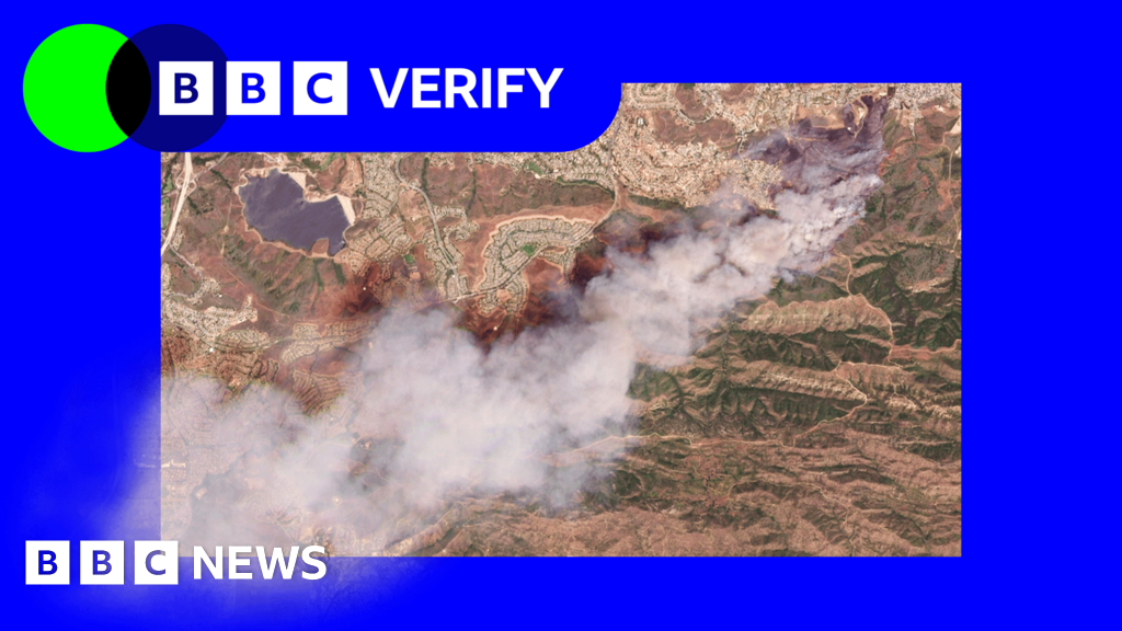
Satellite imagery has confirmed what residents of southern California probably already felt in their lungs: two new wildfires are now burning in the region.
The Sandy Fire ignited Monday morning in Simi Valley, northwest of Los Angeles, according to California Governor Gavin Newsom. Satellite images taken just after noon local time (20:00 BST) show a large plume of smoke rising south of the city, as if the sky itself were giving the region a middle finger.
California fire officials said Tuesday morning that 750 firefighters are being supported by "night-flying water dropping helicopters" to target hotspots - because apparently even fires don't get a break after sundown. The Simi Valley Police Department reported that an individual "hit a rock with a tractor," sparking the blaze, according to the BBC's US news partner CBS. So we can add "agricultural equipment versus geology" to the list of things that can start a wildfire.
The fire has spread across 1,364 acres (550 hectares) with zero containment - a statistic that will surprise absolutely no one. Data from NASA's wildfire monitoring platform shows active hotspots moving further south overnight into Tuesday, because of course they are. More than 10,000 homes have been evacuated from Simi Valley and surrounding communities, with another 3,500 homes under evacuation warnings extending into neighboring Los Angeles County.
Los Angeles Mayor Karen Bass said officials don't expect the blaze to reach the city, but warnings have been issued "out of an abundance of caution" - which is politician-speak for "we have no idea what will happen, but we're covering our bases." The fire's spread was helped by high winds Monday morning that eased later in the day, a fire department spokesperson said.
Simi Valley Unified School District canceled classes Tuesday on all campuses, because nothing says "educational enrichment" like a nearby wildfire. For perspective, around 30 people were killed and more than 10,000 homes destroyed in fast-spreading fires that broke out in the Los Angeles area in January 2025 - a grim reminder that California's fire season is now a year-round affair.
Satellite images also reveal a separate fire on Santa Rosa Island off the coast of Los Angeles, which has burned 14,600 acres (6,000 hectares) of the Channel Islands National Park, according to the US National Park Service. That fire was first reported Friday, but by Monday evening, California fire officials said they had not yet contained any part of it - a phrase that's becoming the state's unofficial motto.
At least 70 firefighters and park rangers have been battling the blaze. The US Coast Guard rescued a 67-year-old man from the island's shore, according to CBS - because apparently even remote islands aren't safe from the flames. Santa Rosa Island is one of five Channel Islands off southern California, almost uninhabited but home to a unique ecosystem of animal and plant life that is now getting an unscheduled barbecue.
NASA's satellite-based wildfire monitoring platform shows the fire has moved northeast over the weekend and now appears to be spreading inland - because fire, much like bad news, has a knack for finding its way everywhere.
The Good Times
News in your inbox.
One sardonic roundup, delivered on your schedule. Free. Unsubscribe whenever your tolerance for wit runs out.
Already subscribed but we never reach your inbox? Check your spam folder and hit 'Not spam' (or 'Remove from spam') to bust us out of junk-mail purgatory. You'll be helping everyone else too.
Don't open any of our emails for a month and you'll be automatically removed from the mailing list.
Rewrite Article
Select parts to regenerate with a fresh AI pass. Translations will be updated automatically.
Generate AI Image
Creates a sardonic version of the article image using OpenAI.