NASA Helps 5th Graders Discover That Indigenous Knowledge and Satellite Maps Are a Surprisingly Good Combo
NASA and Passamaquoddy 5th graders team up to study coastal erosion, proving that satellite maps and elder stories are a powerful - and surprisingly fun - combination.
For the Pleasant Point Passamaquoddy Reservation, or Sipayik, the ocean has always been a teacher - but lately, it's been teaching a course on coastal erosion, and the syllabus is getting shorter. Situated in Downeast Maine along Passamaquoddy Bay, generations of Indigenous people have learned from tides, land, and elders. But the shoreline is changing faster now, slowly taking land that already holds a history of loss.
In summer 2023, inspired by a NASA Science Activation workshop in Fairbanks, AK, the Learning Ecosystems Northeast team began asking: What does coastal erosion mean to people who have already lost land? By November 2024, planning was underway at Sipayik Elementary School to blend Western science with Indigenous knowledge.
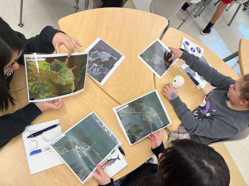
Starting March 2025, nine 5th-grade students spent five weeks exploring erosion. They visited field sites, listened to elders describe how the coastline used to look, used those accounts to measure changes, built erosion trays to test wave effects, measured current high tide lines against historical ones, studied aerial images from 1942 to 2023, and compared 300-year-old tribal maps with future flood projections. As one observer noted, “Our people were scientists without having to go to school.”
The students saw that resilience is part of who they are. In June 2026, they traveled 3.5 hours to the Gulf of Maine Research Institute to present their work to scientists and REU interns. When asked if learning to read maps was difficult, one student reminded everyone those weren't just maps - they were NASA satellite images.
Future goals include inviting more elders, adding field sites, strengthening language and cultural connections, sharing findings with other Native youth, and planning marsh restoration with tribal leadership. When asked if they'd continue this work, all students resoundingly said “YES.” In Sipayik, erosion isn't just about land washing away - it's about memory, identity, and a community that keeps learning from the shore.
The Good Times
News in your inbox.
One sardonic roundup, delivered on your schedule. Free. Unsubscribe whenever your tolerance for wit runs out.
Already subscribed but we never reach your inbox? Check your spam folder and hit 'Not spam' (or 'Remove from spam') to bust us out of junk-mail purgatory. You'll be helping everyone else too.
Don't open any of our emails for a month and you'll be automatically removed from the mailing list.
Rewrite Article
Select parts to regenerate with a fresh AI pass. Translations will be updated automatically.
Generate AI Image
Creates a sardonic version of the article image using OpenAI.