
For more than 50 years, Landsat satellites have been dutifully photographing Earth’s surface in the midmorning sun, because that’s what you do when you’re a satellite with a schedule. But Landsat 8 and Landsat 9 have now discovered a bold new frontier: the dark side of the planet.
On their ascending orbits - fancy satellite-speak for “the part where it’s nighttime” - these satellites are peering into the shadows for special requests, and scientists are suddenly very interested in what happens when the lights go out.
“I’ve seen a noticeable uptick in the number of nighttime imaging special requests,” said Dr. Christopher Crawford, the Landsat Project Scientist at the USGS Earth Resources Observation and Science (EROS) Center. “That’s a very active and innovative measurement science area for Landsat right now.” Crawford, who oversees Landsat’s long-term Earth data acquisition strategy, compared nighttime imaging to Jiffy Baking Mix, because apparently it’s an all-purpose solution for everything from volcanoes to wildfires to melting ice.
While the visible spectral bands (blue, green, red - the same ones your eyeballs use) are mostly useless in the dark, the thermal infrared and shortwave infrared bands can spot heat sources like active volcanoes, wildfires, and geothermal geysers. The exception is twilight at Earth’s poles, where snow and ice temperatures can still be measured even when the sun is taking a nap.
One standout customer is Yellowstone National Park, whose 10,000 thermal features - geysers, hot springs, steam vents - can change temperature or pop in and out of existence like a magic show. Crawford, who is “fascinated by volcanoes in general,” launched a consistent annual campaign to image active volcanoes at night after Landsat 9 launched in 2021, when two satellites together could image every spot on land every eight days.
R. Greg Vaughan of the USGS Astrogeology Science Center, who researches active volcanoes and serves as remote sensing lead for the Yellowstone Volcano Observatory, gave Crawford a list of targets. Vaughan also taught him that winter is the best season for imaging Yellowstone’s thermal features at night, because the contrast between hot features and cold surroundings is greatest. “The thing that I’ve probably taken away the most is that you have to acquire data to then understand what data to continue to acquire,” Crawford said, in a sentence that sounds profound but is basically just “you have to do it to know what to do next.”
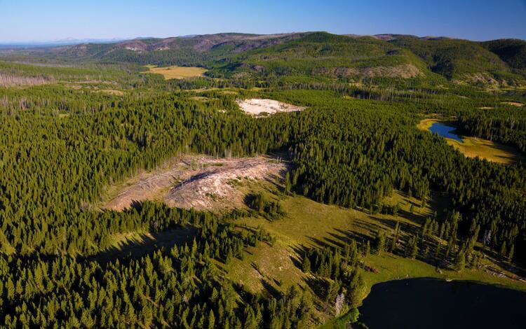
Vaughan spotted an exciting surprise in Landsat 8 nighttime TIRS data from April 2017: a “big blob of bright, warm pixels” that didn’t match any mapped thermal feature. After ruling out a thawing lake, he checked daytime aerial imagery and found bright hydrothermal-altered soil and dead and dying trees - the telltale signs of a new thermal feature. “This is why I love Landsat 8 and 9 so much,” Vaughan said on the Eyes on Earth podcast. “These instruments acquire data regularly, not just during the day, but they can also be tasked to acquire data at night on a regular basis.” Vaughan has since been named to the Landsat Science Team, where his research will focus on active volcanoes.
The fire community in the western United States is also getting in on the nighttime action. The Department of Energy’s Pacific Northwest National Laboratory submits annual special requests for nighttime imaging of seasonal wildfires, and Crawford says the results “compare well to airborne infrared sensing taken from low-altitude flights.” Landsat can even detect gas flares used by the oil and gas industry, and there are regular requests to monitor global sites that produce Liquefied Natural Gas (LNG). Other requests include mapping urban temperatures, which tend to be higher than surrounding areas, and one recent campaign aimed to survey volcanic activity across the entire country of Iceland and its coastline.
Crawford weighs each request carefully, asking: “Does this advance the science mission? Is it serving the user community?” He looks for areas where Landsat imaging data may be underutilized, and apparently nighttime is a goldmine.
A significant advancement came with the Landsat Extended Acquisition of the Poles (LEAP) campaign, led by former Landsat Science Team member Dr. Ted Scambos from the University of Colorado Boulder. LEAP now routinely collects imagery over polar regions, where few wintertime images existed before. The visible-to-shortwave infrared and thermal infrared bands allow scientists to track changes in polar ice sheets, measure surface temperatures, and examine how ocean water interacts with ice shelves. “Snow and ice are still really bright mediums on the surface, and so even if the illumination is low, you can still see a lot of detail because of the high reflectivity,” Crawford said.
Fortunately, nighttime imaging doesn’t burden the satellites - the instruments are always on, so it’s just a matter of whether the data is recorded. Darkness actually helps keep data volumes lower than daytime, giving the satellites plenty of time to pass data off to ground stations. “We’re starting to leverage Landsat 8 and Landsat 9 observatory capabilities to maximum scientific and societal benefit returns,” Crawford said. “We’re populating the Landsat archive with long-term image data records that are helpful for not only quantifying changes on the Earth’s surface right now, but in the past and in the future.”
All imagery collected by special requests is made available to the public through the USGS EarthExplorer website. Just select the “Landsat Collection 2 Level-1” dataset and then choose “Night” under Additional Criteria. Because apparently, the night is still young for Earth observation.