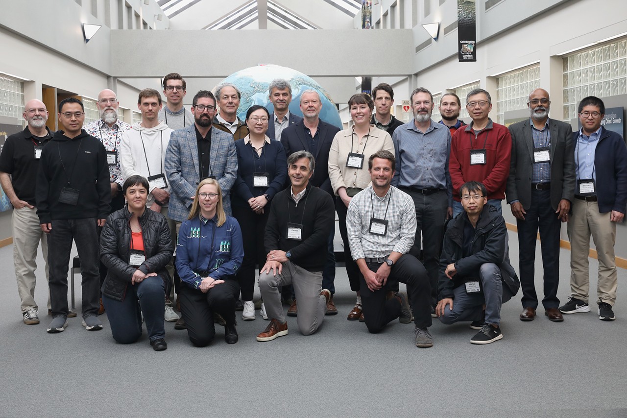
NASA's Landsat Science Team Holds First In-Person Meeting, Realizes Zoom Was Actually Fine
NASA's Landsat Science Team meets in person for the first time, discusses clouds, volcanoes, and why 18-day satellite cycles are bad for algae. Earth observation continues apace.
From May 5 to 7, the 2026 - 2030 Landsat Science Team gathered for their first in-person meeting at the Earth Resources Observation and Science (EROS) Center in Sioux Falls, SD - a location chosen presumably for its proximity to cornfields and excellent internet connectivity. The three-day event, co-moderated by Landsat 8, 9, and 10 Project Scientist Chris Neigh, brought together leaders from USGS and NASA to begin crafting a vision for the next five years of Earth observation.
Attendees shared their current work and future aspirations for the Landsat program, receiving comprehensive updates on the upcoming Landsat 10 project, ongoing interagency and international collaboration on the Harmonized Landsat and Sentinel-2 (HLS) data products, and detailed plans for Collection 3 (C3). Because nothing says 'vision' like a thorough status update on data collections.
Throughout the event, team members representing funded, international, and federal programs showcased the far-reaching impact of Landsat data across various Earth science disciplines - from snow cover mapping and atmospheric correction to water quality monitoring, evapotranspiration, agricultural applications, and volcanic monitoring. In other words, Landsat data is useful for pretty much everything except finding your lost car keys.
The meeting culminated in focused breakout sessions where experts drafted vital recommendations across four key technical areas. The surface reflectance working group identified priorities including topography and adjacency corrections, Bidirectional Reflectance Distribution Function (BRDF) correction, and enhanced cloud masking - because even satellites need help seeing through clouds. They recommended incorporating CMIX2 cloud masking results into future collections and mapping out C3 toolkit dependencies for user-applied corrections.
Discussions on land surface temperature and emissivity centered heavily on maintaining archive consistency. The team recommended either maintaining native resolution or standardizing to 60 meters, with additional testing specifically for volcano studies - because volcanoes are notoriously picky about their thermal data. They endorsed using ASTER GED/CAMEL emissivity datasets and preparing for Landsat 10's five thermal bands through ECOSTRESS comparison. They also called for better quantification of how atmospheric inputs impact harmonization efforts through collaboration between NASA's Jet Propulsion Laboratory (JPL), RIT, and EROS.
Aquatic reflectance experts raised critical concerns regarding Landsat 10's planned 18-day repeat cycle, noting that it severely limits monitoring of highly dynamic processes such as harmful algal blooms - which don't exactly schedule their appearances around satellite orbits. The group called for increased investment in validation infrastructure for inland waters coordinated with international CEOS efforts. They also strongly advised against pixelwise algorithm switching to prevent data discontinuities and emphasized strict compliance with CEOS Aquatic Reflectance V2.0 standards.
Finally, the group reviewing projection and tiling endorsed the USGS pixel grid nesting plan (spanning 10, 15, 20, 30, 60, and 120 meters). However, they recommended further trade analysis to optimize pixel replication errors, manage storage costs, and ensure proper coordination with Sentinel-2 Next Generation. The working group strongly recommended that if these complex grid issues remain unresolved, the program should maintain the Collection 2 approach (UTM and polar stereographic) while continuing to refine Analysis Ready Data (ARD) products for CONUS, Hawaii, and Alaska - essentially, 'if it ain't broke, don't fix it, but also maybe fix it a little.'
The recommendations generated during these breakout sessions created a roadmap for the new Landsat Science Team, ensuring that the global scientific community continues to receive high-quality, actionable Earth observation data through the end of the decade. Or at least until the next in-person meeting.
The Good Times
News in your inbox.
One sardonic roundup, delivered on your schedule. Free. Unsubscribe whenever your tolerance for wit runs out.
Already subscribed but we never reach your inbox? Check your spam folder and hit 'Not spam' (or 'Remove from spam') to bust us out of junk-mail purgatory. You'll be helping everyone else too.
Don't open any of our emails for a month and you'll be automatically removed from the mailing list.
Rewrite Article
Select parts to regenerate with a fresh AI pass. Translations will be updated automatically.
Generate AI Image
Creates a sardonic version of the article image using OpenAI.